
Original monocular depth estimation models. The developers publish relative depth models and separate metric variants.
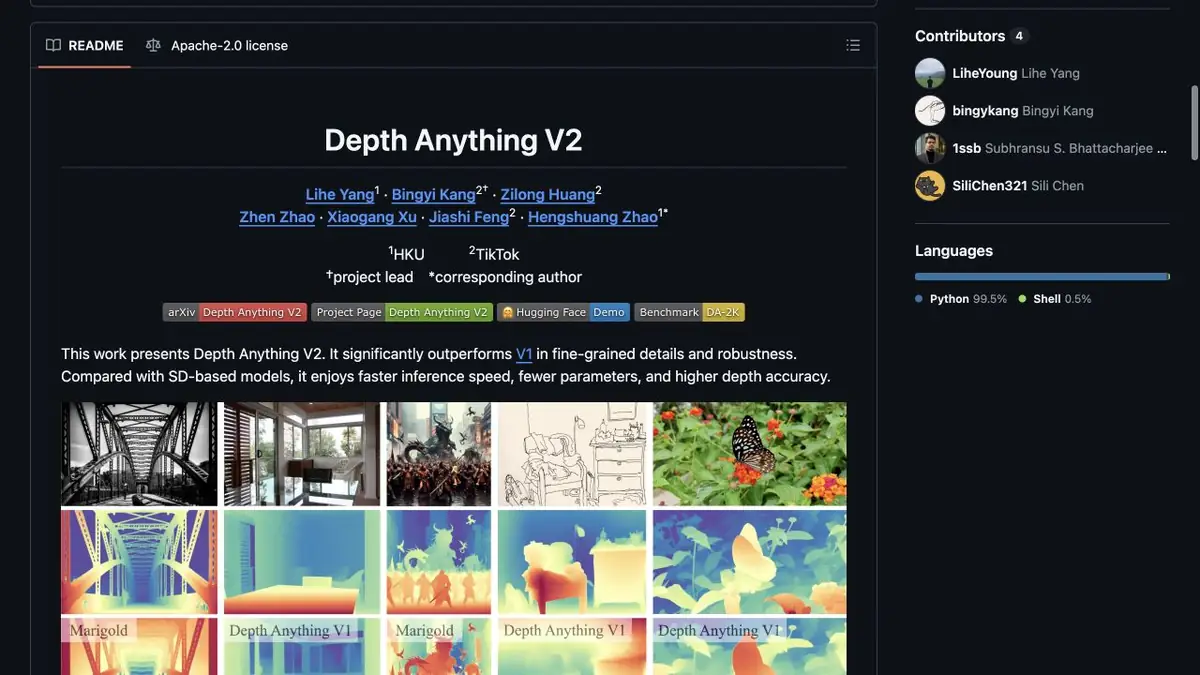
Relative positions of objects
Depth Anything builds a map that shows the estimated depth at the points of the shot. In relative mode, it is convenient to compare what is closer or further away. For scale in meters, authors publish individual trained options. Before taking the result into the project, specify the type of card and how to save it. A color scale image for viewing may contain less useful data than a numerical result.
A window and a table in one frame
For a study sample, rent a room with a chair in the foreground and a window behind. Get a map and check whether the legs of the chair, table and far wall are different. Then look at the reflection in the window glass. The algorithm can evaluate it as part of a separate space, although a layer of glass is needed for the composition. If the card is used for weak camera movement, check what will appear in places that the chair has fenced.
Leave the original frame nearby. When the edge of the map is noticeably shifted, it is easier to compare it with a photo and manually limit the processing of the problem area.
Choose model weights and a license
The repository describes the different scale of the model and individual options for metric estimation. Check available memory, specific weights license and the purpose of the selected version. To measure the real distance, you need control dimensions or an independent method of verification. In a visual composition, it is more important to make sure that the boundaries and relative positions of objects are suitable for the planned movement.
Suitable tasks
- Prepare a depth map for the composition
- Check the visibility of the boundaries between plans
Strengths
- Depth is estimated by one frame
- There are relative and separate metric options
Limitations
- A map can be wrong on transparent surfaces
- Relative depth does not give distance in meters
Selection and conditions
- Free access
- Yes
- Trial period
- Not confirmed
- No sign-up required
- Not confirmed
- Russian interface
- Not confirmed
- Local installation
- Yes
- API
- Not confirmed
“Not confirmed” means there is not enough information. The feature may still be available; check the developer’s terms.
- Input formats
- Image
- Result
- Depth map
Terms
For local processing, set the environment and download the appropriate weights. Developers document several sizes of models.From task to first result
Practical example
- Task
- Prepare a depth map for the composition
- What to prepare
- A picture with a clear foreground and several objects at different distances.
Task brief or prompt
Build a depth map and compare the relative position of objects with the original image. Leave the source unchanged.
Expected result
Depth map for visual verification.
How to check the result
- Check near and far objects.
- Separately, look at the transparent surfaces and thin contours.
An editorial teaching example of a task brief, not the result of hands-on testing of the service. Check that the required mode is available, that you have rights to the source material and that the intended use of the result is permitted.
Check details
Official sources
This description is based on the developer’s material. Features, prices and availability may change; check the primary source before use.